Site Access and Parking
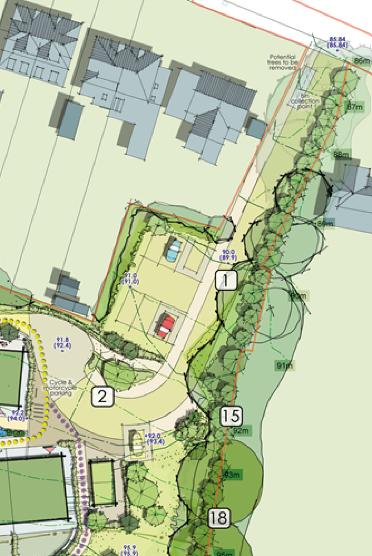
Vehicular access to the site would be via a 4.8m wide access road between Nos. 89 and 87 Englishcombe Lane. Where it meets Englishcombe Lane there would be a footway crossover to prioritise pedestrian movements. A 1.5m wide footway will be provided on the western side of the access road into the development.
The arrival area includes parking for six cars, including two blue badge spaces. Within the wider arrival space there is a drop-off and pick-up area, including one blue badge parking space and minibus drop-off point. This area also includes cycle/ tricycle and motorcycle parking stands. The second cluster of dwellings has a further drop-off and pick-up area, including a further blue badge parking space and additional cycle/tricycle parking.
Site access and parking - click to enlarge
Traffic generation
An Automatic Traffic Count (ATC) survey was conducted on Englishcombe Lane in early February. This showed an average of around 3,300 vehicles using the road on a daily basis, with an average recorded speed of 21.5mph. The development is not anticipated to generate a significant number of vehicular trips per day - trips will primarily be made by carers or visitors to the site, rather than residents themselves.
Refuse strategy
A refuse strategy has been developed for the site which takes into account the needs of residents and considers both site location and proposed layout of the dwellings. The strategy is for communal refuse storage and collection, with the various components shown in the Refuse Strategy Plan. Each cluster of dwellings contains a communal bin store, with sufficient space for communal household waste and recycling bins. Communal bins will moved to a collection point along the access lane on bin collection day.
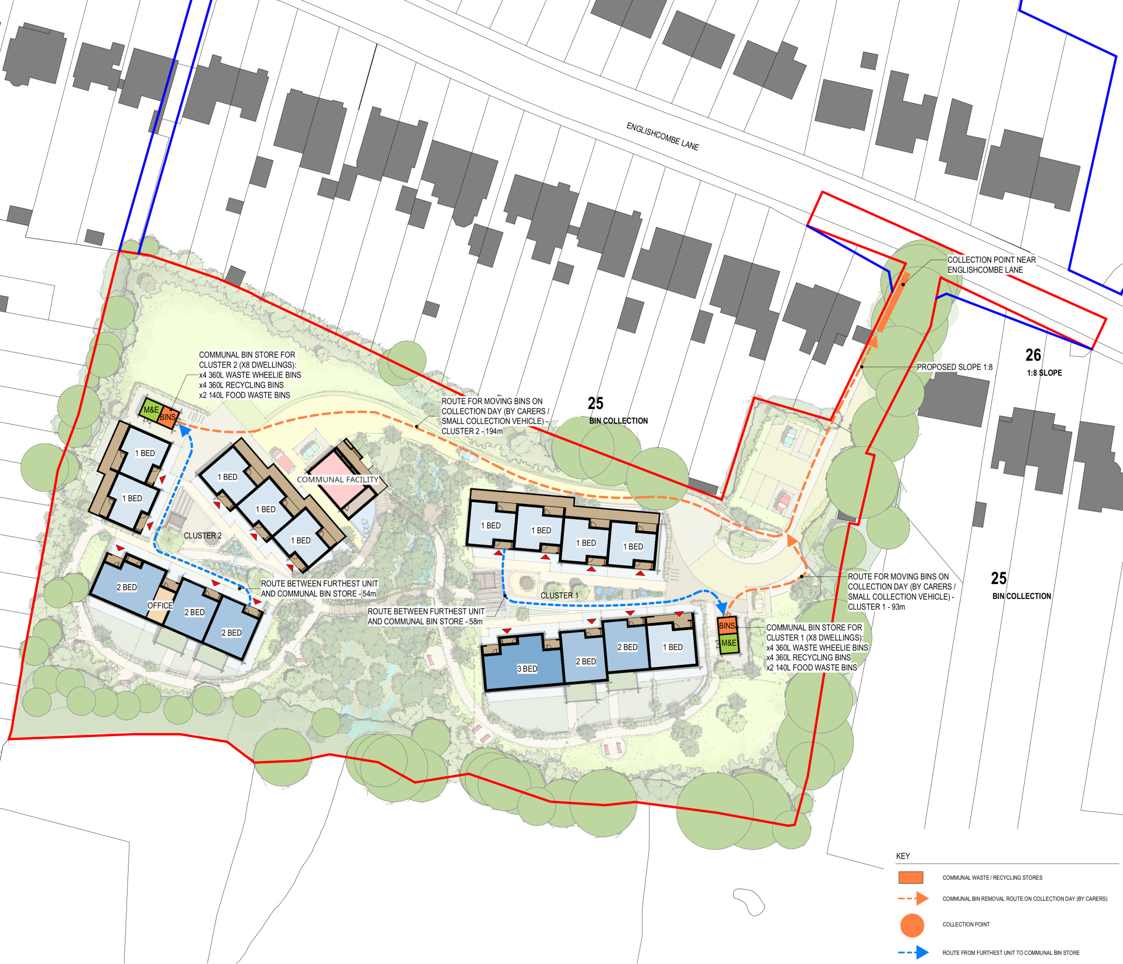
Refuse strategy - click to enlarge
Emergency access strategy
The layout of the site has been designed in a way that would allow sufficient space for emergency vehicles to gain access, as is shown in the Emergency Access Plan. The orange dotted line shows an access route extending from the main entrance around the site. There will be a compliant turning point at the end of the access lane, with three ‘stop zones’ incorporated to ensure access is possible to all residential units. In case of a requirement for a wider evacuation, two assembly points are shown.
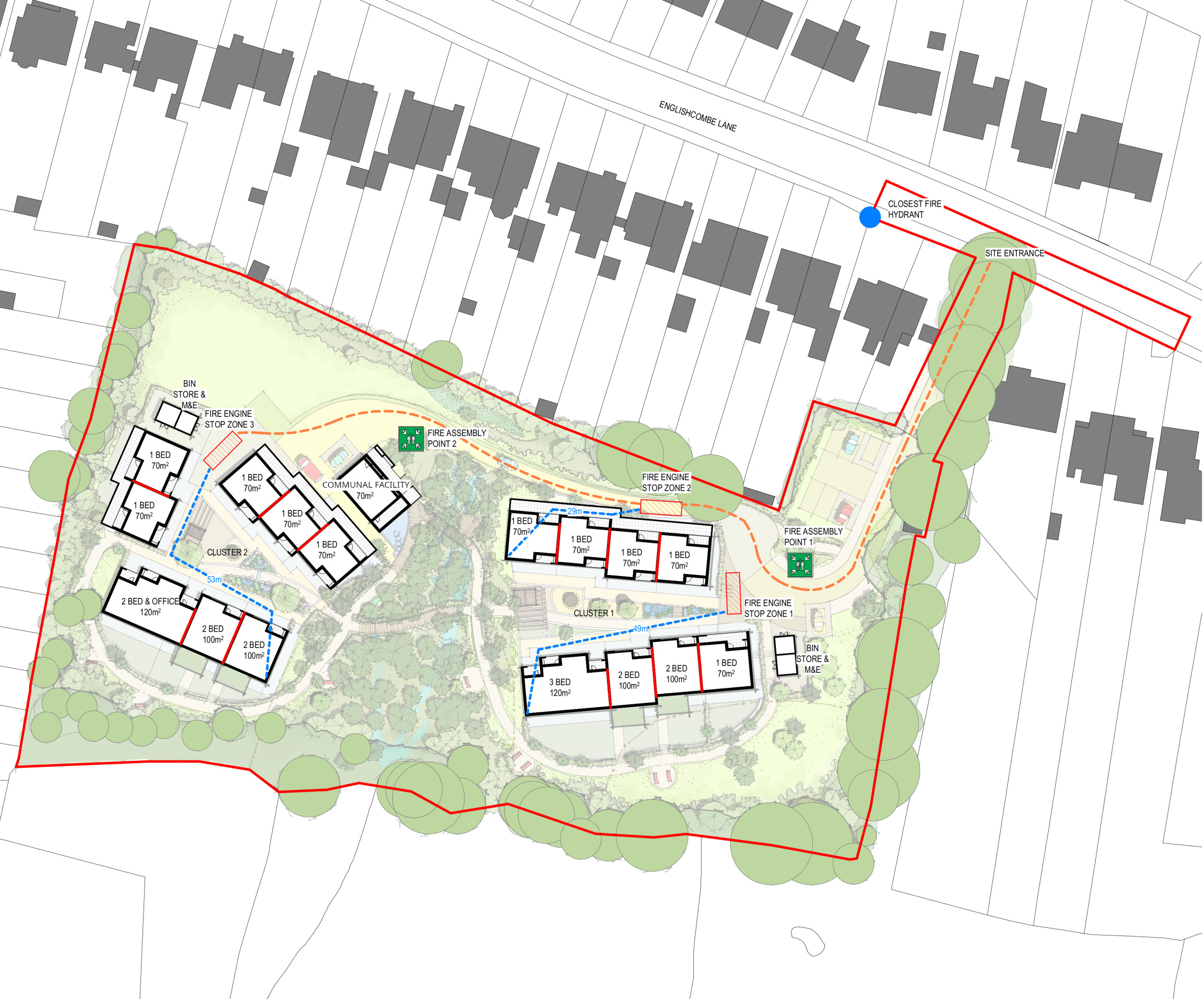
Emergency access plan - click to enlarge